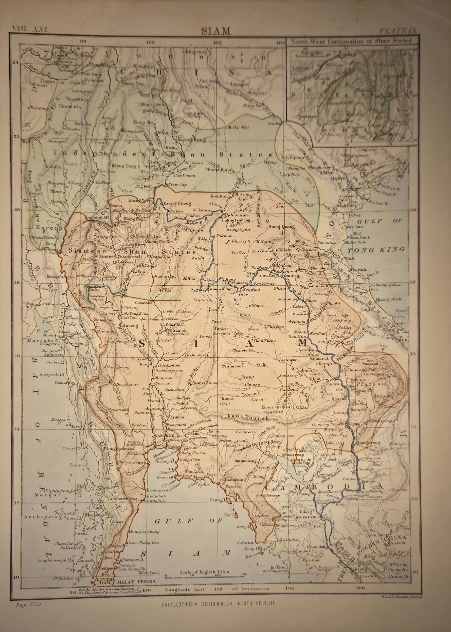
Siam (Vol. XXI, Plate IX, Page 850, Encyclopaedia Britannica, Ninth Edition) — engraved by the renowned Scottish cartographers W. & A.K. Johnston of Edinburgh and London, this map presents a detailed depiction of Siam (modern-day Thailand) and its surrounding regions as understood in the late 19th century. Issued as part of the Ninth Edition of the Encyclopaedia Britannica (1875–1889), it was intended as a reference for scholars, students, and general readers seeking authoritative geographic knowledge of Southeast Asia.
Numbered Plate IX in Volume XXI, page 850, the map captures both physical and political geography with careful precision. Rivers, mountain ranges, and coastlines are delineated, with hachures used to indicate relief and elevation. The map also provides an important historical record of Siam’s contemporary borders, showing its boundaries with neighboring states, including Burma (Myanmar) to the west, French Indochina (modern-day Laos and Cambodia) to the east, and the Malay Peninsula to the south. These borders reflect the political realities prior to significant colonial encroachments and internal territorial adjustments in the late 19th century, making the map valuable for understanding Siamese sovereignty and regional geopolitics at the time.
Major cities such as Bangkok, Ayutthaya, and Chiang Mai are clearly marked, along with rivers like the Chao Phraya and Mekong, essential for trade, transportation, and regional connectivity. Roads, forts, and settlements are also indicated, giving a sense of infrastructure and population centers.
Engraved on fine atlas-quality paper, the map exemplifies the clarity, accuracy, and aesthetic quality for which W. & A.K. Johnston were known. It reflects both the scientific rigor of Victorian-era cartography and the encyclopaedic commitment to public education. Collectors and historians value this map not only for its geographic and topographic information but also as a document illustrating Siam’s historical borders and its position within Southeast Asia before major colonial changes.
This map is a significant historical and educational artifact, combining precision, visual elegance, and scholarly authority, making it highly desirable to collectors of 19th-century maps, Southeast Asian history, and encyclopaedic cartography.
Additional information
| Author | W. & A.K. Johnston (engraver) |
|---|---|
| Publisher | Encyclopaedia Britannica, Ltd |
| Published On | 1875 to 1889 |
| Country | Edinburgh: United Kingdom |
| Dimension | 19.5cm x 27.5cm |
| Item Weight | 10gm |
| Edition | Ninth Edition |