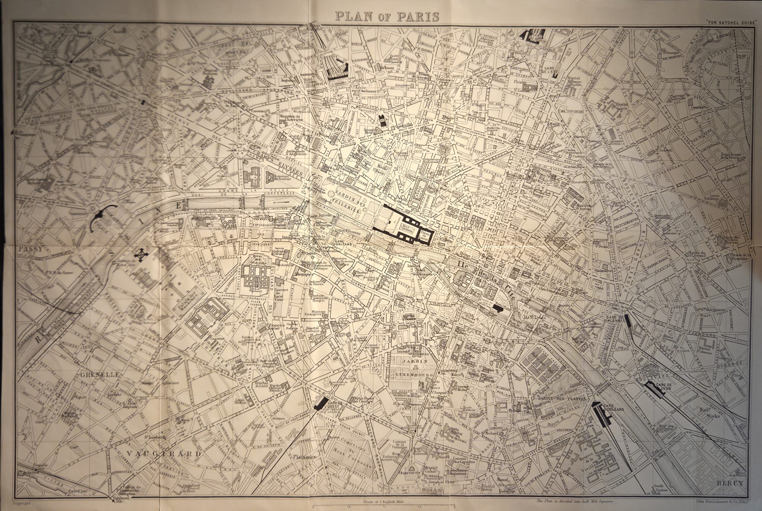
The Plan of Paris Map from the 1929 Satchel Guide was produced by John Bartholomew & Son, Ltd., a respected cartographic firm. This map offers a meticulously composed portrait of Paris during a pivotal historical moment. Its lines are precise yet expressive, capturing a city still shaped by nineteenth-century planning even as it modernizes. Major boulevards, monuments, and transit lines are clearly delineated, serving both as navigational beacons and cultural markers. The Seine bisects the map with quiet authority, reaffirming its role as the city’s central spine. Metro stations are carefully mapped, signaling a burgeoning network attentive to urban growth. Compact but rich in detail, the map strikes a refined balance between utility and design—guiding travelers through a Paris steeped in history, sophistication, and civic ambition.