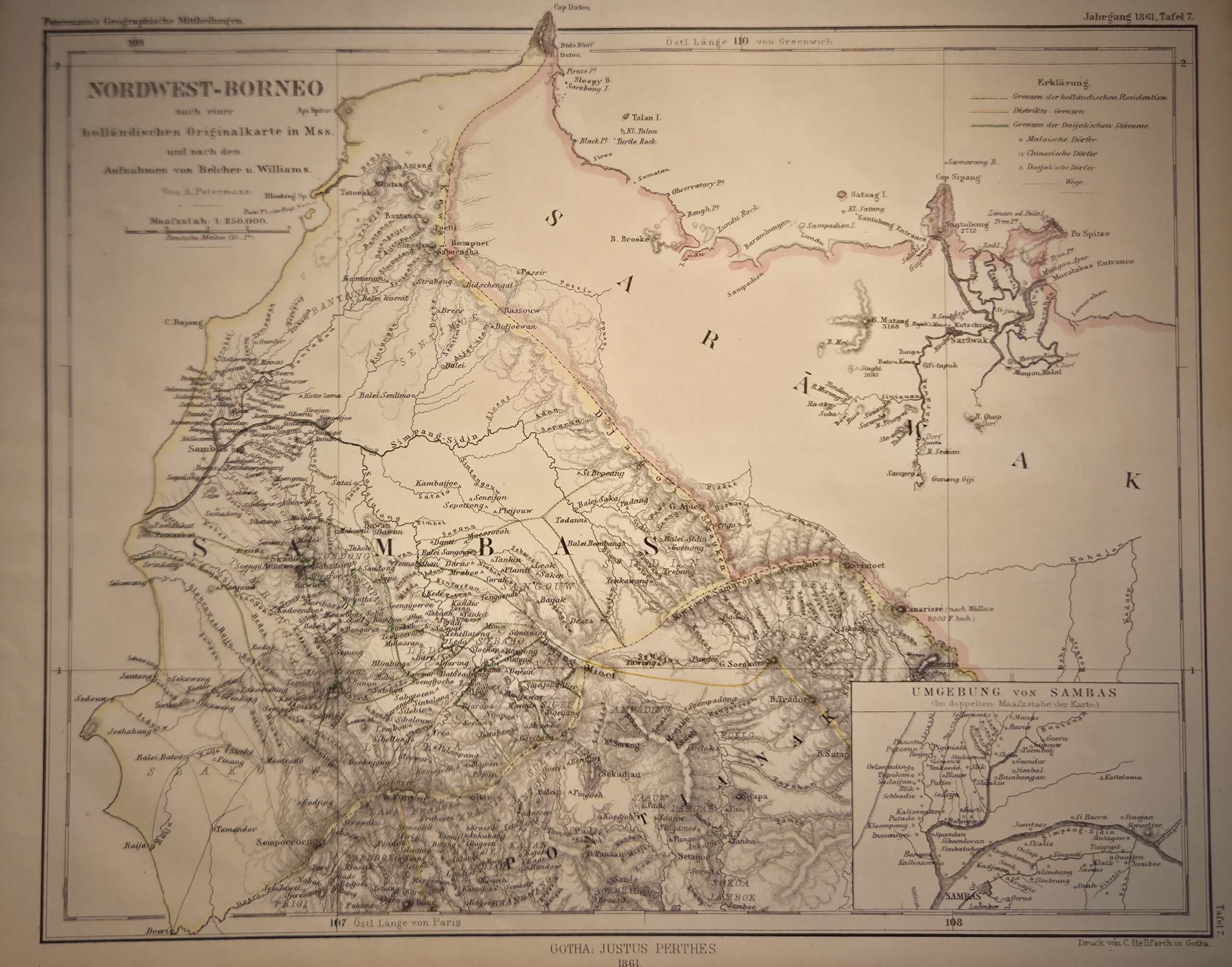
Nordwest-Borneo, Hollandischen Besitzungen (1861) — published by Justus Perthes in Gotha, Germany, this map presents a detailed depiction of northwest Borneo, highlighting the Dutch colonial possessions during the mid-19th century. As a product of one of Europe’s leading cartographic publishers, it reflects both the precision and aesthetic quality characteristic of German 19th-century cartography.
The map carefully illustrates rivers, mountain ranges, settlements, and coastlines, combining topographical detail with political information. Dutch-controlled territories are clearly demarcated, showing administrative divisions and areas under European authority, while adjacent regions of Borneo are depicted for geographic context. Coastal features, ports, and river systems are accurately represented, providing insights into trade routes and navigational considerations of the era.
Engraved on fine-quality paper, the map demonstrates the Perthes firm’s commitment to clarity, accuracy, and visual elegance, making it both a practical geographic resource and an object of aesthetic appeal. Its publication in Gotha, Germany, ensured wide European distribution and reinforced Perthes’ reputation for authoritative atlases and maps.
Collectors and historians value this sheet for its historical representation of Dutch Borneo, its cartographic quality, and its role in illustrating European perspectives on Southeast Asian geography during the colonial period. The map remains a significant artifact of 19th-century colonial cartography and exploration.
Additional information
| Weight | 10 g |
|---|---|
| Dimensions | 27 × .005 × 21.5 cm |
| Author | Unknown (perhaps August Heinrich Petermann, who worked at the Perthes firm) |
|---|---|
| Publisher | Justus Perthes |
| Published On | 1861 |
| Country | Gotha, Germany, |
| Language | German |
| Dimension | 27cm x 21.5cm |
| Item Weight | 10gm |