
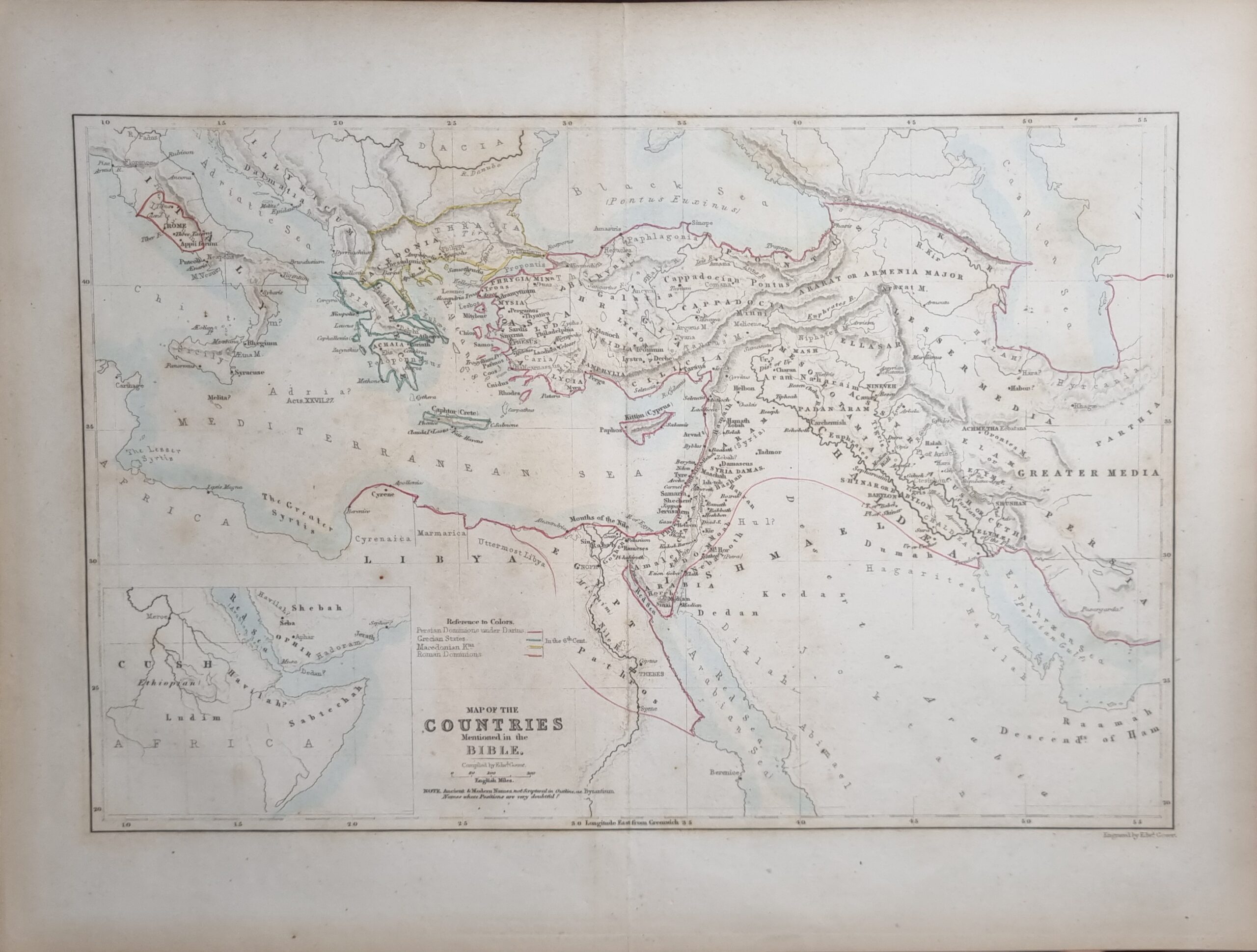
This map engraved by Edward Gover stretches from Rome, Italy down to Libya and Across to Persia and up to Armenia. This hand coloured C1880c map defines the Persian Dominions, The Grecian States as well as the Roman Dominions as well as others.
Additional information
| Weight | 68 g |
|---|---|
| Dimensions | 35.5 × .05 × 26.5 cm |
| Author | Edward Gover (engraver) |
|---|---|
| Published On | 1880s |
| Language | English |
| Dimension | 35.5cm x 26.5cm |
| Item Weight | 68gm |