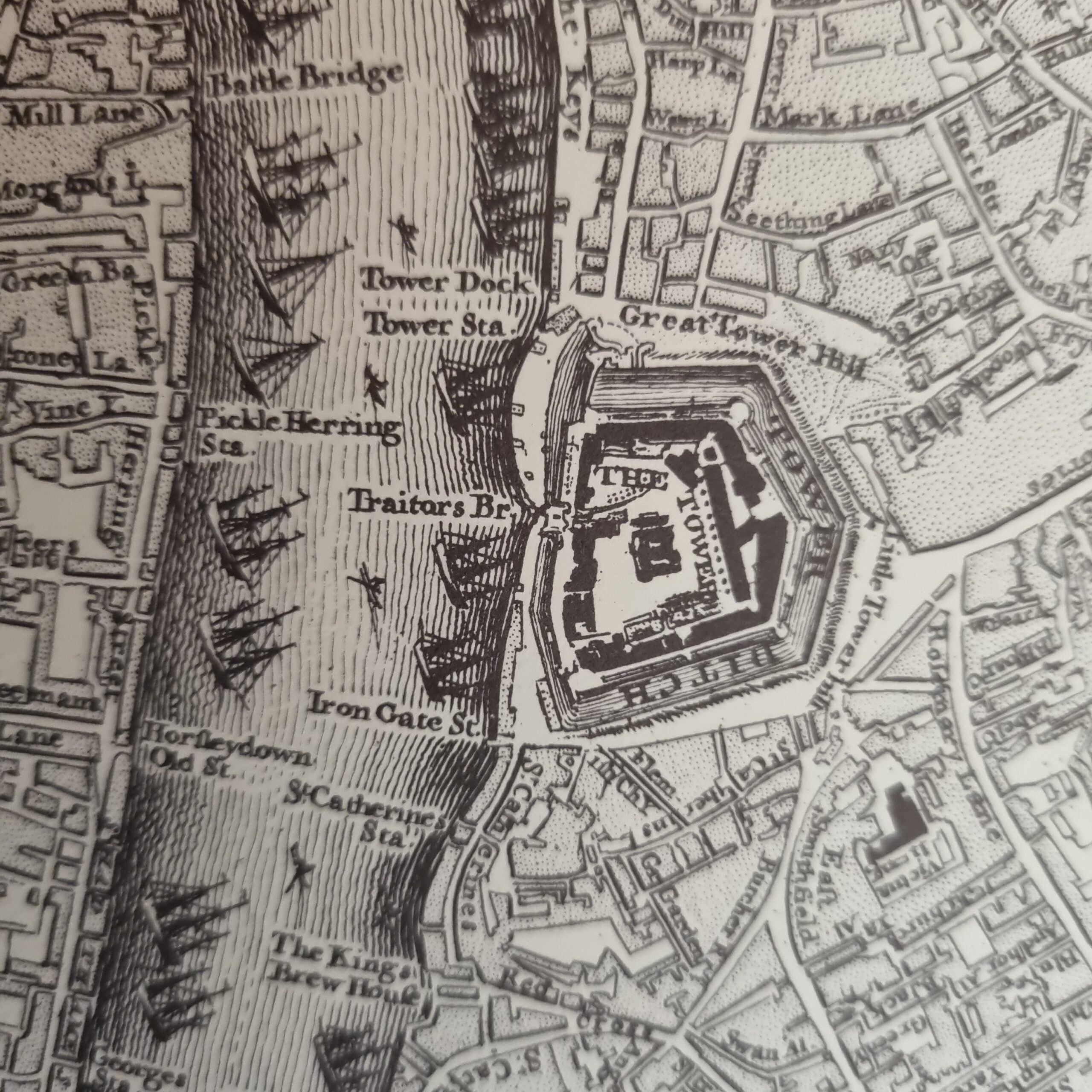
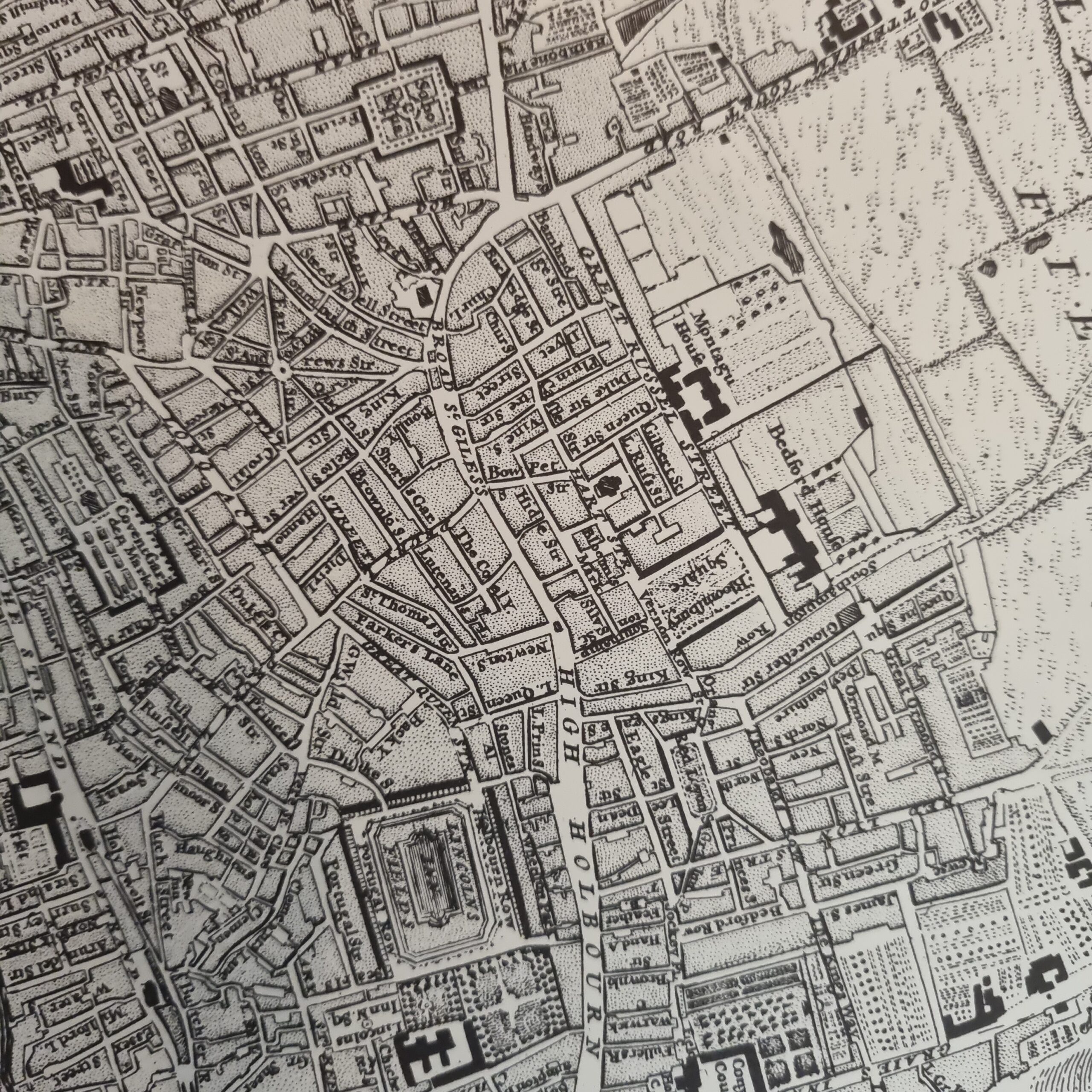
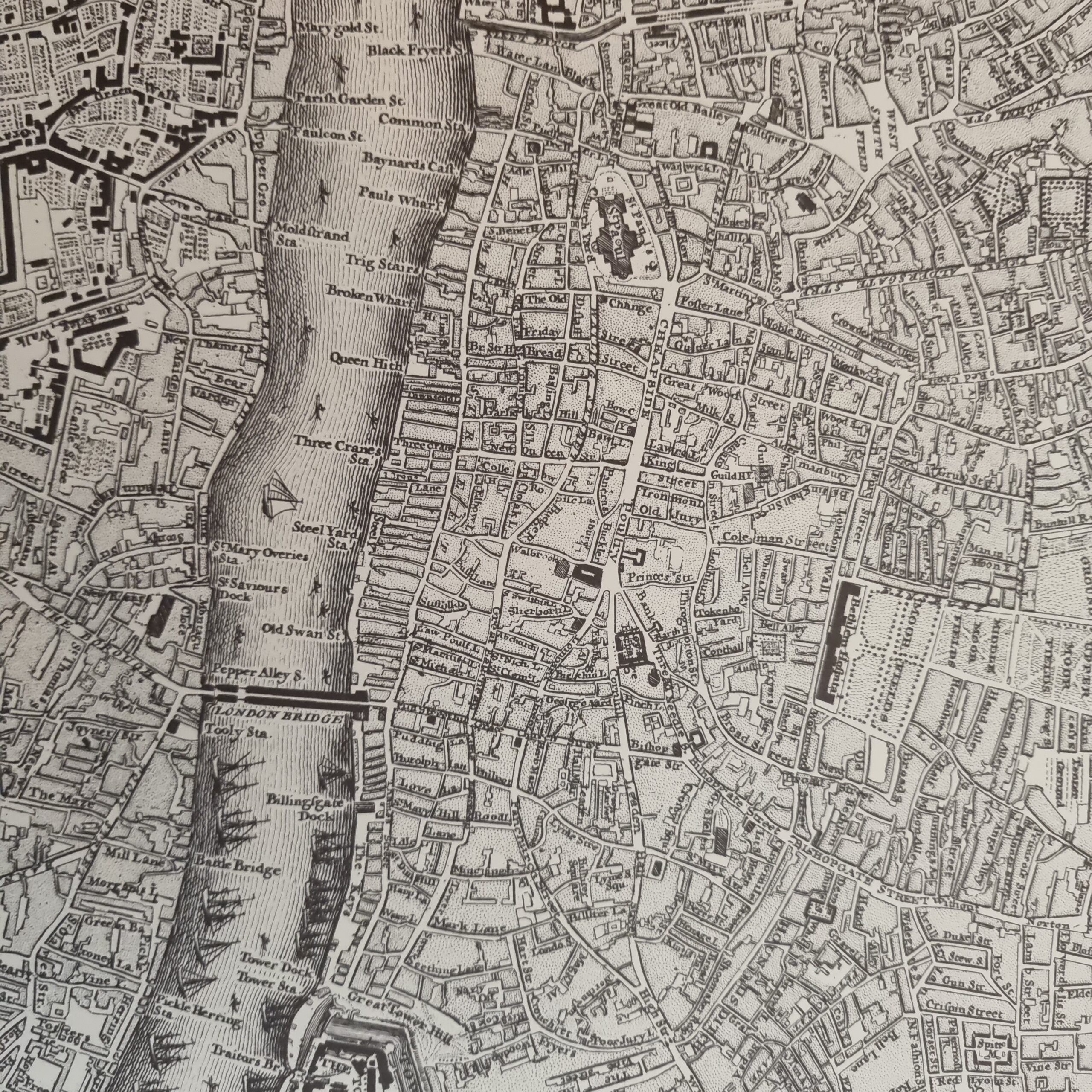
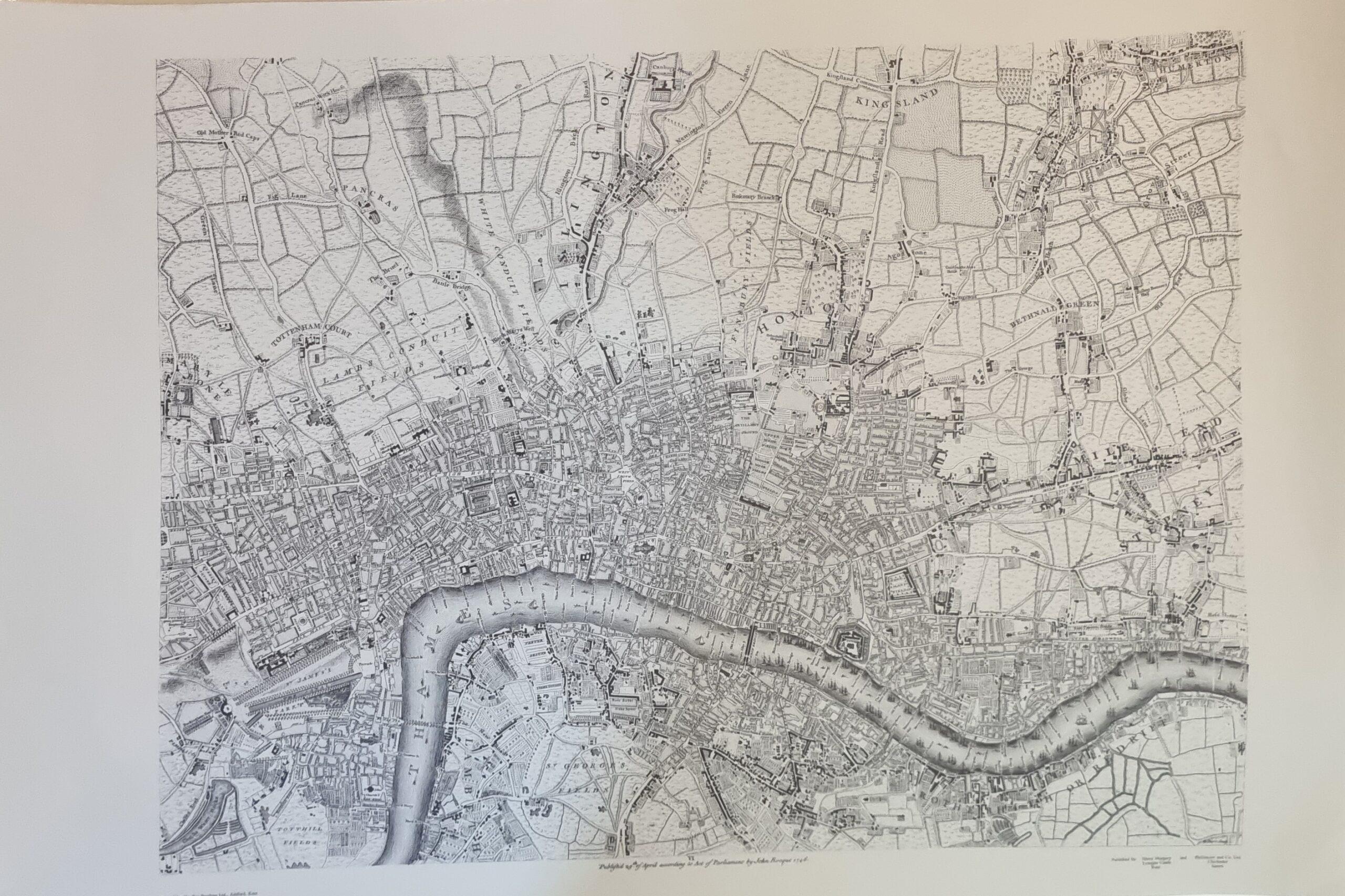
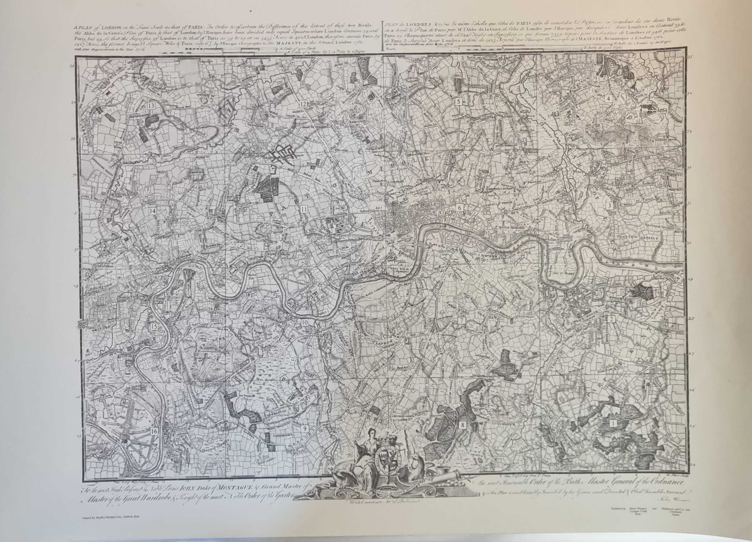
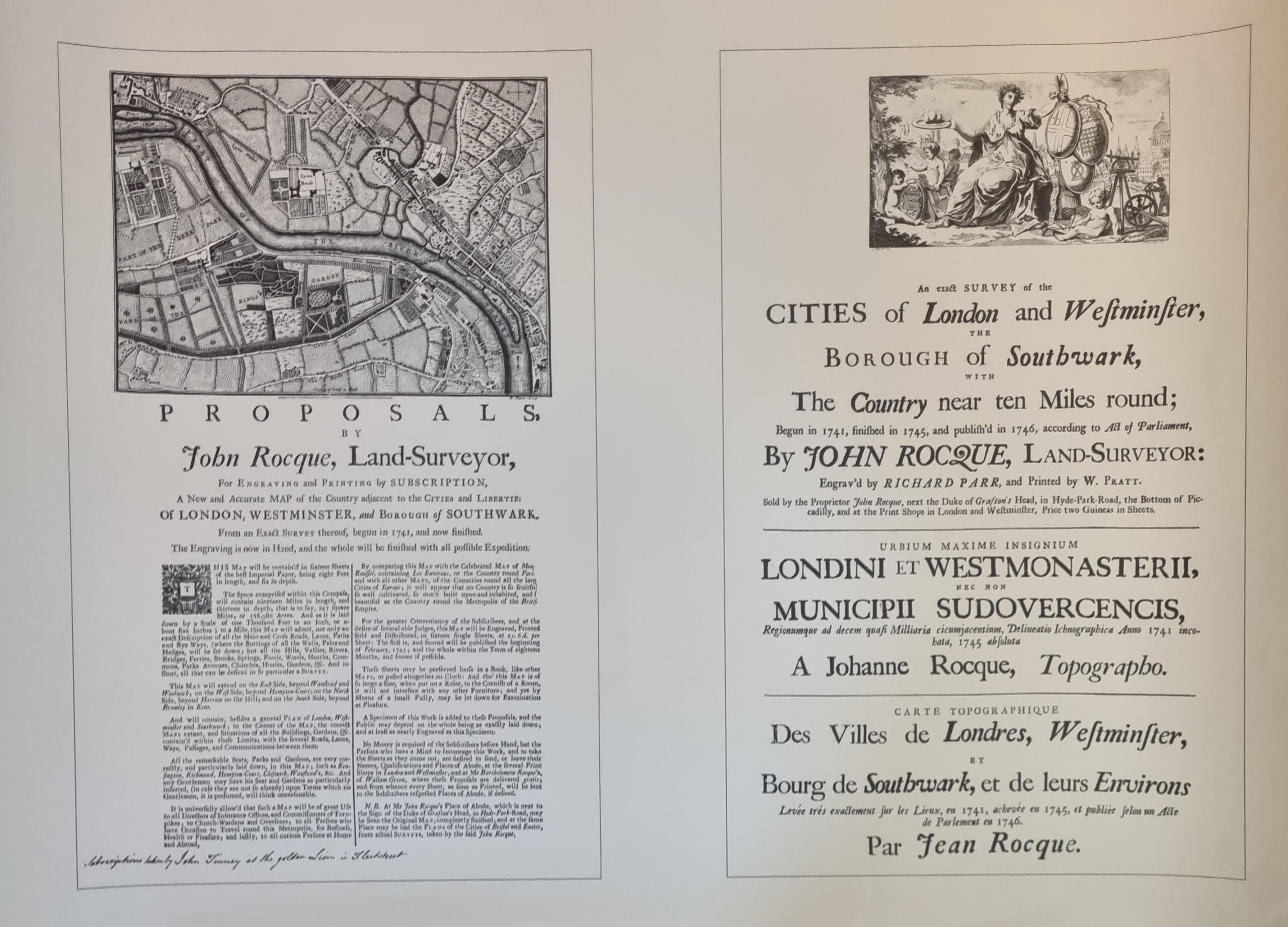
In 1746, the French-born British surveyor and cartographer John Rocque produced two maps of London and the surrounding area. The better known of these has the full name A Plan of the Cities of London and Westminster, and Borough of Southwark: it is a map of Georgian London to a scale of 26 inches to a mile (i.e. 1:2437), surveyed by John Rocque, engraved by John Pine, and published in 1746. It consists of 24 sheets and measures 3.84 m × 2.01 m (12 ft 7 in × 6 ft 7 in). Taking nearly ten years to survey, engrave and publish, it has been described as “a magnificent example of cartography … one of the greatest and most handsome plans of any city”.