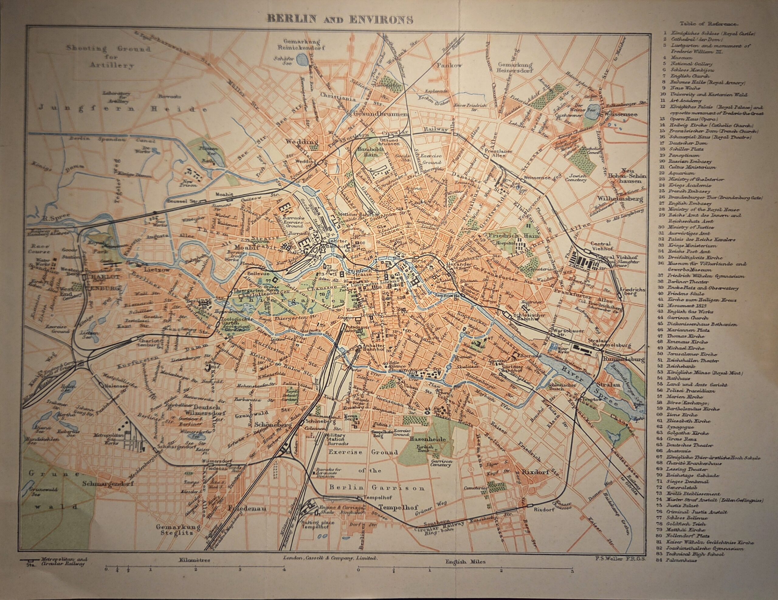
Berlin and Environs, engraved by Edward Weller, F.R.G.S., and published by Cassell & Company, Limited, is a detailed mid‑19th century map originally produced for The Dispatch Atlas (London, 1863). This finely engraved work captures Berlin and its surrounding areas during a period of rapid urban and industrial growth, offering a precise depiction of streets, waterways, and topographical features. The map’s meticulous line work and clear labeling reflect Weller’s renowned cartographic skill, providing both aesthetic appeal and functional clarity.
Major thoroughfares, railway lines, and natural features such as rivers and forests are carefully delineated, while smaller villages and suburban developments are also marked, giving a comprehensive view of Berlin’s environs before the city’s later expansion. The engraving bears the initials F.R.G.S., underscoring Weller’s professional standing as a Fellow of the Royal Geographical Society.
Originally part of a serialized atlas issued by the Weekly Dispatch, this map was later incorporated into Cassell’s Complete Atlas, reflecting the Victorian appetite for accessible, high-quality cartography. Measuring approximately [insert dimensions], it exemplifies 19th-century British engraving techniques and the intersection of practicality and artistry in mapmaking. This piece is an exceptional example of historical urban cartography, valuable for collectors, historians, and enthusiasts of German and European geography.
Additional information
| Weight | 10 g |
|---|---|
| Dimensions | 30 × .005 × 23 cm |
| Author | Edward Weller, F.R.G.S. (engraver) |
|---|---|
| Publisher | Cassell & Company, Limited |
| Published On | C1863 |
| Country | London: United Kingdom |
| Language | English |
| Dimension | 30cm x 23cm |
| Item Weight | 10gm |