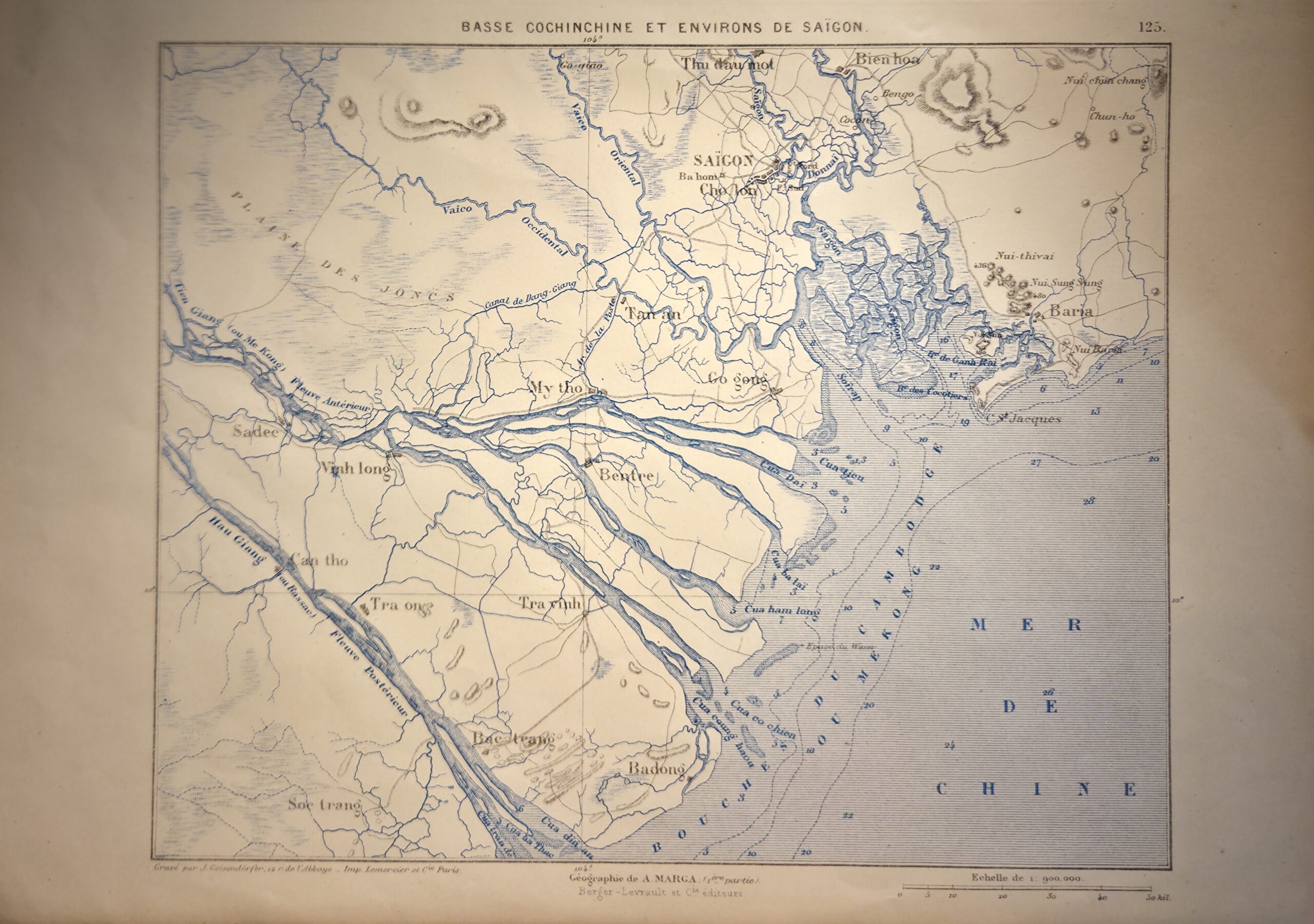
Basse Cochinchine et Environs de Saigon — originally surveyed by Leopold Manen, Felix Vidalin, and Gabriel Heraud (1861–64) and engraved by J. Geisendorfer, this reproduction map depicts the southern Vietnamese region of Cochinchina, focusing on Saigon and its surrounding environs. Printed on smooth paper in blue ink, it is a later issue rather than an original 1867 copper-plate impression published by the Depot des Cartes et Plans de la Marine, yet it preserves the detail and structure of the original survey.
The map illustrates the intricate network of rivers, canals, and settlements that characterize the Mekong Delta, with Saigon prominently marked to reflect its strategic and economic significance during the early phase of French colonial expansion. Administrative boundaries and key geographical features are rendered clearly, demonstrating the precision of the original surveyors’ work.
J. Geisendorfer’s engraving style is evident in the fine linework and carefully lettered place names, now presented in a single colour for visual clarity. While not hand-coloured, the map retains a decorative and scholarly appeal. This reproduction is of interest to collectors of Southeast Asian cartography, French colonial surveys, and 19th-century historical maps, offering a compact, visually striking representation of Cochinchina and the environs of Saigon.
Additional information
| Weight | 10 g |
|---|---|
| Dimensions | 30 × .005 × 21 cm |
| Author | J. Geisendorfer (engraver) |
|---|---|
| Publisher | Depot des Cartes et Plans de la Marine |
| Published On | c. 1880–1930 |
| Country | France: Belguim |
| Language | French |
| Dimension | 30cm x 21cm |
| Item Weight | 10gm |