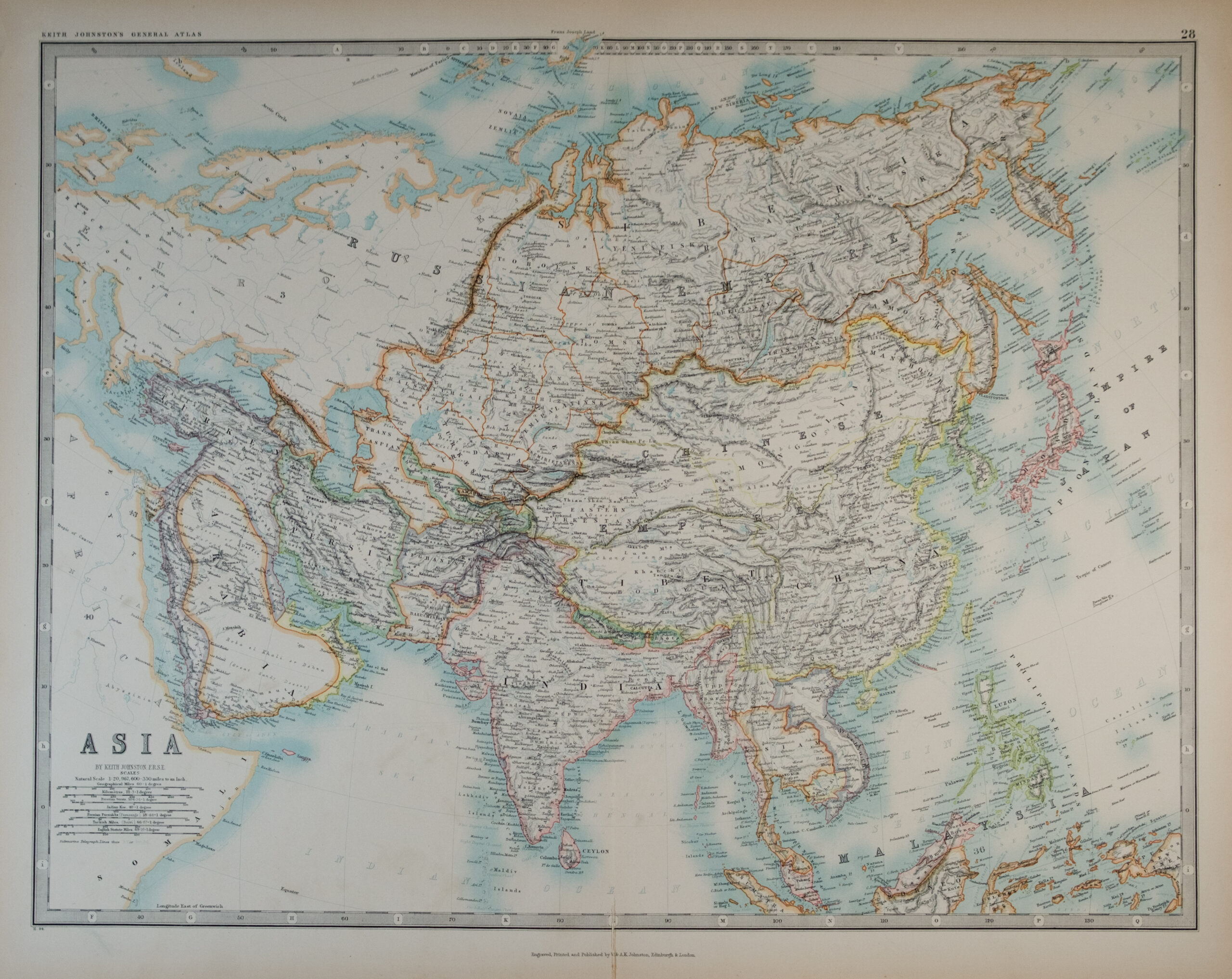
A finely engraved mid-19th-century map of Asia by the noted Scottish cartographer Alexander Keith Johnston. This map presents the political and geographic understanding of the continent in the years immediately preceding major colonial and imperial realignments. Borders are delineated in original hand-colour, with especially detailed attention to mountain ranges, river systems, and administrative units of the period.
Japan is shown with its pre-Meiji organization, labelled “Yedo,” indicating a date prior to 1868. India appears under British influence yet still includes the Kingdom of Oudh, annexed by Britain in 1856, and Burma remains outside British control. Southeast Asia is depicted with “Anam” and “Cochin China,” reflecting a period before the establishment of French Indochina (from 1858 onward). Central Asia retains the large, pre-Russian-expansion designation “Independent Tartary,” confirming that this map predates the major Russian territorial advances of the 1860s–1880s. The Sino–Russian frontier is shown in its pre-Aigun/Peking Treaty configuration, further narrowing the publication window.
Taken together, these geopolitical indicators strongly support a date of circa 1850–1855, aligning with the early editions of Johnston’s General Atlas.
Johnston’s atlases were among the most authoritative of their era, prized for scientific accuracy, clarity of engraving, and elegant hand-colouring. This map offers a snapshot of Asia at a moment of profound transition—just before sweeping political, colonial, and cartographic changes reshaped the region.
Typically found in early editions of Keith Johnston’s General Atlas, first issued in the early 1850s.
Additional information
| Weight | 50 g |
|---|---|
| Dimensions | 62.5 × .05 × 50 cm |
| Author | Cartographer: Alexander Keith Johnston (1804–1871) |
|---|---|
| Publisher | W. & A.K. Johnston |
| Published On | c1855 |
| Pages | 1 |
| Country | Edinburgh: United Kingdom |
| Language | English |
| Dimension | 62.5cm x 50cm |
| Item Weight | 50 gm |