Latest Map of the Russo-Japanese Battle Areas
Original lithographed map on paper. Moderate overall age toning Original center and horizontal folds as issued, with wear and softening along fold lines; folds stable. Minor edge and corner wear, with a few small marginal splits and abrasions consistent with newspaper supplement use. No major tears or losses. Printed image and text remain clear and legible throughout. Overall good condition for a Meiji-period wartime news map.
$65.79
1 in stock
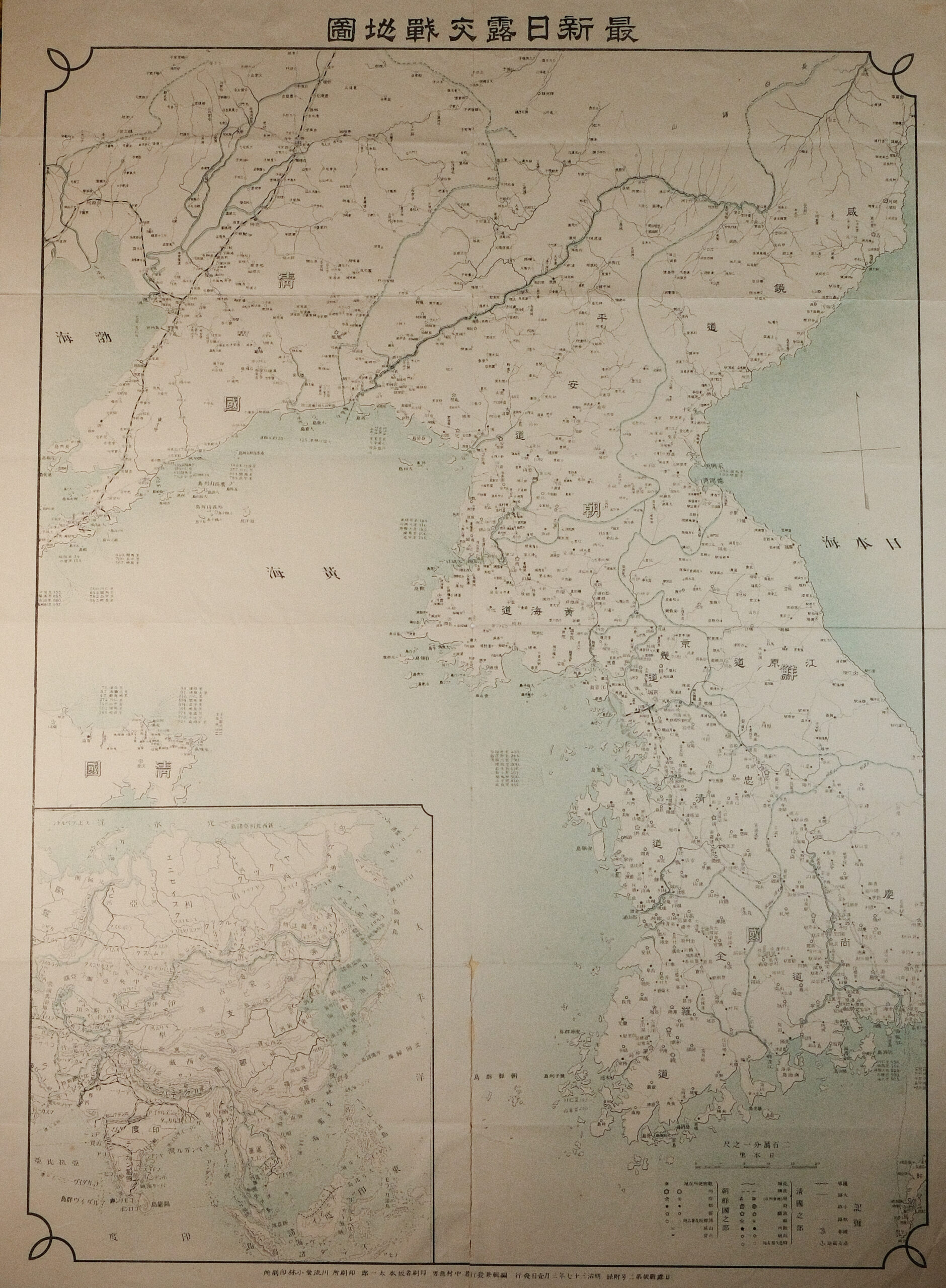
A Meiji-period Japanese wartime map titled Saishin Nichiro Kōsen Chizu (Latest Map of the Russo-Japanese Battle Areas), depicting the principal theaters of conflict during the Russo-Japanese War (1904–1905). The map centers on Korea and Manchuria, extending to northern China and surrounding seas, with strategic emphasis on railways, ports, rivers, and key battle locations.
Military engagements and operational zones are indicated through symbols and annotations, while coastal waters and naval routes are clearly delineated. An inset map at lower left provides broader regional context within East Asia, situating the conflict within Japan’s expanding continental interests.
The map was produced as a newspaper or periodical supplement, a common format during the Russo-Japanese War, when Japanese publishers issued regularly updated maps to inform the public of battlefield developments. The use of the word “latest” in the title indicates that this map was intended as a timely visual report rather than a static reference work.
Although no individual cartographer is named, such maps were typically compiled by editorial staff using military communiqués and official reports. Major Japanese newspapers of the period played a central role in disseminating war information and shaping public understanding of Japan’s first modern overseas conflict.
This map documents Japan’s emergence as a modern imperial power following its victory over Russia, a watershed moment in global and Asian history. Its detailed treatment of Korea—six years before formal annexation in 1910—underscores the peninsula’s strategic importance in Japanese military planning. As an object of wartime journalism, the map also illustrates the close relationship between mass media, cartography, and public opinion in Meiji Japan.
Catalogue note: A rare and evocative example of Japanese wartime news cartography from the Russo-Japanese War, combining strategic geography with contemporary reportage.
Additional information
| Weight | 50 g |
|---|---|
| Dimensions | 40 × .05 × 55 cm |
| Publisher | Japanese newspaper publisher, issued as a news supplement (likely Tokyo-based) |
|---|---|
| Published On | 1904–1905 (Meiji period) |
| Country | Japan |
| Language | Japanese |
| Dimension | 40cm x 55cm |
| Item Weight | 50gm |