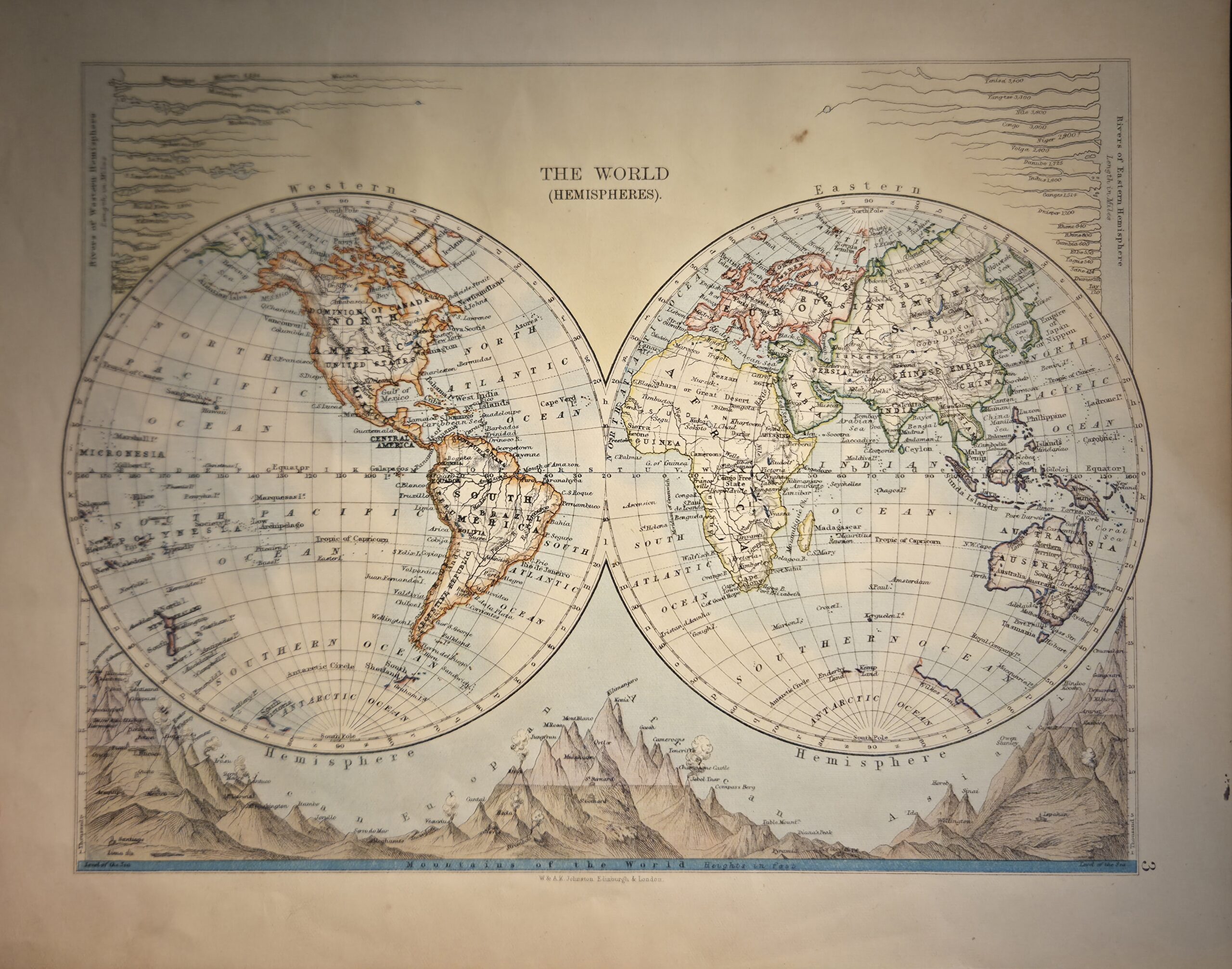
The World in Hemispheres (Plate 3, Colored Edition) — engraved by Alexander Keith Johnston, F.R.S.E. and published by W. & A.K. Johnston of Edinburgh & London, this late 19th- or early 20th-century map presents a visually striking depiction of the globe in twin hemispheres. Numbered “3”, it was originally issued as plate 3 in one of Johnston’s atlases or educational reference works.
This chromolithographed and hand-colored edition emphasizes physical geography, clearly illustrating the major mountain ranges of the world and the rivers of both the Eastern and Western Hemispheres. The colored rendering differentiates continents, highlights key landforms, and enhances the visual clarity of relief, making topographic and hydrographic features immediately readable. Mountains are depicted using hachures to indicate slope and elevation, while rivers are distinctly traced and labeled.
Printed on high-quality paper, this map exemplifies Johnston’s combination of scientific precision and aesthetic elegance, suitable for both educational use and decorative display. Its publication in a well-regarded atlas reflects the Johnston firm’s status as a leading British cartographic publisher in the 19th and early 20th centuries. Collectors of historical world maps, physical geography, and chromolithographed atlases will find this map particularly appealing for its color, detail, and scholarly accuracy.
Additional information
| Weight | 10 g |
|---|---|
| Dimensions | 30 × .005 × 23.5 cm |
| Author | Alexander Keith Johnston, F.R.S.E. (engraver) |
|---|---|
| Publisher | W. & A.K. Johnston |
| Published On | c1890s |
| Country | London: United Kingdom |
| Language | English |
| Dimension | 30cm x 23.5cm |
| Item Weight | 10gm |