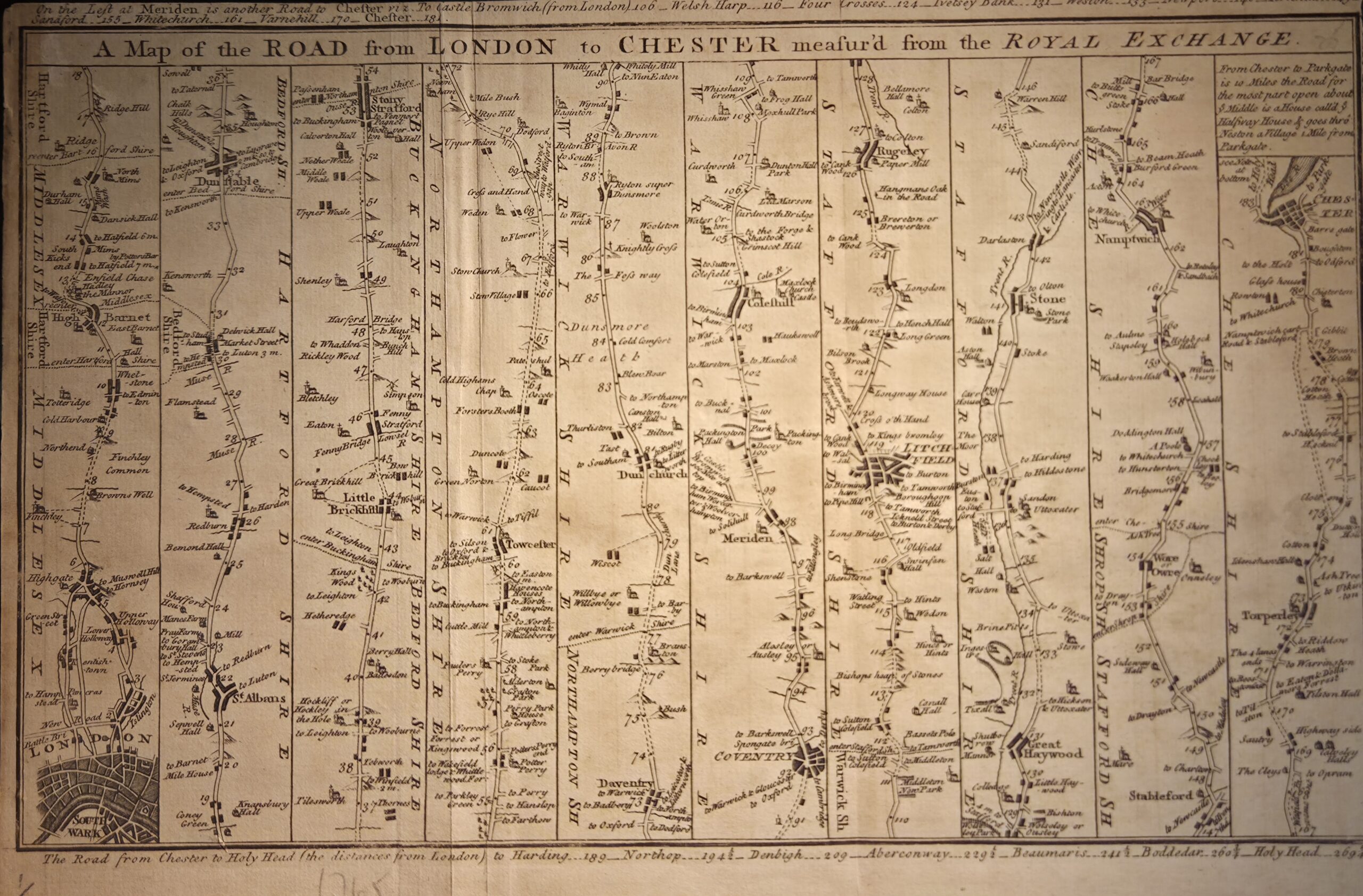
A Map of the Road from London to Chester measured from the Royal Exchange — published circa 1765 in The Gentleman’s Magazine, London, this finely engraved strip map charts the principal route from the heart of the capital to the historic city of Chester. Distances are measured from the Royal Exchange, reflecting the 18th-century practice of using a central, well-known landmark as the point of departure.
The map traces a linear path through key towns and market settlements, including High Barnet, St. Albans, Dunstable, Towcester, Daventry, Coventry, Lichfield, Stone, and Nantwich, providing travelers with both directional guidance and the relative spacing between stops. Its design typifies the strip-map style popular in the mid-18th century, emphasizing sequential travel rather than geographic scale, while small engraved details denote bridges, crossroads, and other notable features along the route.
Engraved with clarity and precision, the map exemplifies the blend of utility and artistry characteristic of period road maps, offering both practical information for travelers and aesthetic appeal for collectors. Its publication in Gentleman’s Magazine reflects the growing demand for accessible cartography among the literate public, extending the reach of maps beyond official surveys to a wider audience.
This map is of particular interest to collectors of 18th-century British road maps, transportation history, and early magazine cartography, providing a rare snapshot of a major arterial route in pre-turnpike England.
Additional information
| Weight | 10 g |
|---|---|
| Dimensions | 30 × .005 × 20.5 cm |
| Author | Gentlemens Magazine - Possibly - John Gibson |
|---|---|
| Publisher | Gentlemens Magazine |
| Published On | c1765 |
| Country | London: United Kingdom |
| Language | English |
| Dimension | 30cm x 20.5cm |
| Item Weight | 10gm |